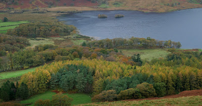
Crummock Water is situated between Buttermere to the south and Loweswater to the north. Crummock Water is 2.5 miles (4.0 km) long, 0.6 miles (0.97 km) wide and 140 feet (43 m) deep.
The River Cocker is considered to start at the north of the lake, before then flowing into Lorton Vale. The hill of Mellbreak runs the full length of the lake on its western side; as Alfred Wainwright described it 'no pairing of hill and lake in Lakeland have a closer partnership than these'. The lake is owned by the National Trust.
Scale Force, the highest waterfall in the Lake District, feeds the lake and has a drop of 170 feet (52 m).


No comments:
Post a Comment