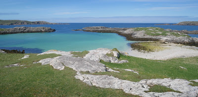
I had originally planned a trip elsewhere today. Thankfully I visited Uig instead which was a truly uplifting penultimate day on the Outer Hebrides Islands. The day included some walking and driving to take in all I could from the area. Its a fantastic mix of mountains, cliffs and beaches.
Uig is a civil parish and community in the west of the island of Lewis. It consists of scattered settlements around the bay of Camas Uig and the Bhaltos peninsula. The name derives from the Norse word Vik meaning 'a bay'.
According to the 2011 Census, there are 873 Gaelic speakers (56%) in the Uig area.
The Butt of Lewis is the most northerly point of Lewis in the Outer Hebrides. The headland, which lies in the North Atlantic, is frequently battered by heavy swells and storms and is marked by the Butt of Lewis Lighthouse.
it achieves a mention in the Guinness Book of Records for being the windiest place in the UK. Look West from here and there's nothing between you and North America: look north and it's open ocean all the way to the Arctic.
The walk also takes in Dùn Èistean which is a multi-period archaeological site on an inter- tidal sea stack on the north east coast. It is accorded the status of traditional stronghold of Clan Morrison - once a highly powerful family within the Lordship of the Isles - in local oral tradition. The ruins of two large buildings and groups of inter-connecting cellular structures can be seen amongst the grassy tussocks on the top of the island, as well as an artificial pond and a low turf wall enclosing the site. The most prominent feature of the site is a large circular mound of rubble situated on the highest point of the stack, on the north east side of the site.


